GBAS Overview
Designed specifically for the maritime sector, Ground-Based Augmentation System (GBAS) with build-in Integrity Monitoring functionality and purpose-designed RTK Control Software (RCS) provides the most straightforward means of establishing Real-Time Kinematic services for your harbour and docking areas. The GBAS solution offered by NavSim is fully compliant with the relevant IALA and IMO standards on integrity monitoring, precision, continuity, and availability.

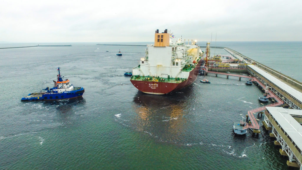
Piloting and Docking |
| Piloting large vessels in the congested waterway in poor weather conditions and mooring them with an approach speed no greater than 15 cm/s is everything but an easy task. That is why only specialised and most experienced harbour pilots are trained and allowed to do this kind of job. The ability to safely navigate vessels and adhere to local mooring requirements is possible only with access to reliable and accurate real-time positioning. And this is precisely where NavSim GBAS delivers – providing pilots with horizontal positioning at sub-centimetre level accuracy, along, bow and stern speed of the vessel at centimetre per second and rate of turn at 0.1 degrees. |

Dredging |
| Dredging activities such as land reclamation, waterway construction, dyke construction, artificial island construction, beach nourishment, and others require centimetre level precise positioning provided by Real-Time Kinematic (RTK) technologies. NavSim GBAS solutions for demanding applications offer high accuracy positioning up to 20 miles from the shore that consistently results in increased productivity, saves time and money. |
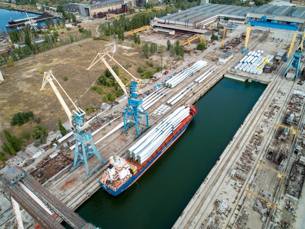
Construction works |
| The construction of offshore infrastructures such as pipelines, subsea equipment and production platforms relies heavily on accurate positioning provided by NavSim’s precise positioning solutions. With RTK over IP technology, whether you are along the coastlines or miles out to sea, NavSim has your construction application needs covered. |


Surveying |
| As time goes by, the harbour and waterway floor is accumulating sand which is carried away by waves, rivers and the deep sea streams. By performing regular surveying the authorities ensure that the area is free from obstruction and the depth is sufficient for safe passage for vessels. Complex surveying tasks require adequate equipment and tools to ensure high performance and reasonable value-for-money results. And this is when NavSim GBAS solution for surveyors come into play. NavSim state-of-the-art RTK for surveying applications is the solution that enables determining the topography of the seabed at accuracy in X,Y,Z better than 10cm at a reasonable cost. |
Moving cargo |
| Never lose or misroute a container again. As the container traffic is booming, the process of handling large amount of containers becomes more complex and prone to errors. Typical error rates range up to several percentage points, leading to thousands of “lost” containers a year. With NavSim GBAS tools for the yard cargo operations any irregularities in the container movement are instantly brought up to the attention of the operators and management allowing for timely corrections. More efficient cargo management translates into better performance on the container yard, reduction in throughput times and increased safety at the workplace. |
One solution for many applications
In order to deliver the best possible results maritime pilots, construction workers, dredging teams, surveyors, crane operators and other professionals who operate in coastal and harbour areas rely heavily on local positioning infrastructure. NavSim GBAS with IALA-grade Integrity Monitoring combines high performance sensors for reliable and accurate differential Real-Time Kinematic (RTK) corrections to make their job more effective.
Piloting and Docking
Piloting large vessels in congested waterway in poor weather conditions and mooring them with an approach speed no greater than 15 cm/s is everything but an easy task. That is why only specialised and most experienced harbour pilots are trained and allowed to do this kind of job. The ability to safely navigate vessels and adhere to local mooring requirements is possible only with access to reliable and accurate real-time positioning. And this is precisely where NavSim GBAS delivers – providing pilots with horizontal positioning at sub-centimetre level accuracy, along, bow and stern speed of the vessel at centimetre per second and rate of turn at 0.1 degree.
Dredging
Dredging activities such as land reclamation, waterway construction, dike construction, artificial island construction, beach nourishment, and others require centimetre level precise positioning provided by Real-Time Kinematic (RTK) technologies. NavSim GBAS solutions for demanding applications offer high accuracy positioning up to 20 miles from the shore that consistently result in increased productivity, saves time and money.
Constructing
The construction of offshore infrastructure such as pipelines, subsea equipment and production platforms relies heavily on accurate positioning provided by NavSim’s precise positioning solutions. With RTK over IP technology, whether you are along the coast lines or miles out to sea, NavSim has your construction application needs covered.
Surveying
As time goes by, the harbour and waterway floor is accumulating sand which is carried away by waves, rivers and the deep sea streams. By performing regular surveying the authorities ensure that the area is free from obstruction and the depth is sufficient for safe passage for vessels. Complex surveying task require adequate equipment and tools to ensure high performance and reasonable value-for-money results. And this is when NavSim GBAS solution for surveyors come into play. NavSim state-of-the-art RTK for surveying applications is the solution that enables determining the topography of the seabed at an accuracy in X,Y,Z better than 10cm at a reasonable cost.
Moving the cargo
Never lose or misroute a container again. As the container traffic is booming, the process of handling large amount of containers becomes more complex and prone to errors. Typical error rates range up to several percentage points, leading to thousands of “lost” containers a year. With NavSim GBAS tools for the yard cargo operations any irregularities in the container movement are instantly brought up to the attention of the operators and management allowing for a timely corrections. More efficient cargo management translates into a better performance on the container yard, reduction in throughput times and increased safety at the workplace.